Leh – Ladakh

A Barren Beauty That Bedazzles The Brain!

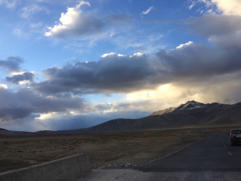
‘Jullay’! This Ladakhi greeting is your gateway into the hearts and hearths of the friendly Ladakhi people, and will serve you well while travelling this desolate, cold desert full of natural wonder and earthly delights.

A mesmerizing place, Ladakh is –
as Yoda from Star Wars would put it

There are so many sights to see that the Ladakh region, along with its most populated city, Leh, exceeds any amount of time you stay there for. From one of the highest motor-able roads in the world, culminating at Khardung La (‘la’ means mountain pass) to the ultimate beauty that is on display at the Pangong Tso (‘tso’ means lake), Ladakh is a rainbow of sights and sounds – just try standing quiet for a moment next to any of the streams along the mountain roads, and listen to the wind and water roar!

If driving to Ladakh under your own steam, make sure you obtain your vehicle passes and Inner Line Permits from the government administrative offices in Leh for visiting Pangong and/or Nubra valley, since they are towards the Line of Actual Control towards China and Pakistan, respectively.

Extraordinary Travel Experiences

  • CANNOT MISS: In Leh city:
    • Leh Palace is the most important landmark, with a treasure trove of history and special significance for Buddhists. More than five hundred years old, this royal residence rises through narrow, steep wooden staircases in a maze-like setting to nine floors! From the top, a marvelous panoramic view of the snow-capped peaks in the distance and the entire valley of Leh is visible, although in recent years the level of construction activity following the cloud burst in 2010 has expanded to the upper reaches of the mountainside on which this Palace stands. Far off in the distance, the Stok Kangri rears its mighty head, which you can see if luck shines on you in the form of sunlit and cloudless skies!
    • Tsemo Castle or Namgyal Tsemo Monastery is the highest point of Leh, and is barely five minutes uphill from the Leh Palace. Must visit for its truly immense golden Maitreyi Buddha statue
    • Shanti Stupa (Peace Dome) built in 1991 atop a part of the relics of the Buddha through Kushok Bakula (an Indian lama after whom the airport is named) as well as the Japanese’s efforts to promote world peace
    • War Museum is a showcase of the bravery and solidarity of the Indian Armed Forces, reached by driving or walking a short distance down the Leh highway
    • Datun Sahib, a tree so named due to an auspicious visit by the founder of Sikhism, Guru Nanak, located right in the main market
    • Spituk Monastery, near the Leh airport which is also named after the monastery’s founder
  • EXCURSIONS:
    • Pangong Tso is unique in that it is shared by India and China! Get a visitor’s pass before you head this way through Chang La, the actual pass – where the highest seed vault in the world is maintained in collaboration with DRDO! Pangong is spectacularly beautiful in the mornings and evenings, so there are multiple tent-hotels along the shore if you want to catch both the sunrise and the sunset colors as they change the surface of the lake into a fireworks display!
    • Monasteries – Thiksey and Shey, fall along the route to Pangong, while Stok is in the opposite direction, an equally short drive away from Leh city. Alchi is a one thousand year old (thus very historical) architectural site, located sixty kilometers from Leh towards the west.
    • Khardung La claims to be the highest mountain road in the world, and it is not far off the mark, at a mind-numbing, bone-chilling 17,500 feet! En route Siachen Glacier (not accessible to civilians), this road leads to Nubra Valley and its major towns, Diskit and Hunder, where you must go to see the double-humped Bactrian camels! Grab as many Leh berry juice boxes as you can, for a shot of nutrients straight from the source! Head on to Turtuk, the last village in India proper, for chilling – literally – amidst apricot groves and pristine cold sand dunes!

Out-of-the-Ordinary Tourism Options

Trekking is not for everyone, and especially in high altitude regions like Leh – Ladakh. For the adventurous (and in tip top shape) people, Chadar trek in the Zanskar valley and bicycle trips along the Leh-Srinagar and Leh-Manali highways have become popular in the past few years. There is also a Ladakh Marathon, for those so inclined (no pun intended)!

Take some time to acclimatize to the scarce air, so that you can enjoy the local cultural dishes and culinary preparations. The Buddhist, Tibetan and Muslim convergence throws up an array of souvenirs and keepsakes that are unique to Ladakh.

Visiting The Vicinity

Best Months To Visit: Peak summers, May to September

Height Above Mean Sea Level: ~11,000 feet, 3,500 meters

Cities:  Leh, Lamayuru, Diskit, Kargil

Airport: Leh

Read more about our experiences here!

(1 of 4)

Above Kullu/Manali, Himachal Pradesh, India

Access: Road: Drive up from Chandigarh (about 6 hours) or Delhi (overnight).

Air: Fly into Bhuntar airfield from Delhi or Chandigarh.

20160609_080357

Literally above the clouds at 2,652 metres (8,701 ft), Malana is reached by trekking for an hour from Nirang (where a dam is under construction), accessible by road from Jari in the Parvati valley above Bhuntar.

20160613_191414

Nowadays, to conserve the pristine environment, visitors are encouraged to stay at Nirang, so that they can trek to Malana (or onwards) without leaving a lasting impact on nature. Indeed, the heaps of trash littering the walking path made such steps necessary, and we visited just in time, I’d say.

20160615_105248

From a few dozen wood-and-mud houses, the village has become a concrete town, as you can see in my pic above. Thankfully, this should remain the furthest extent of so-called development for a few decades. With the Nirang dam coming up soon, it might spell disaster for the culture. Fingers crossed against that!

20160615_190858


Leh Ladakh June 2017: Part 4

Leh – Pangong Tso Lake (night stay) – Leh


Above: Pangong Tso, looking towards China 

After a refreshing night’s sleep, we obtained our permit for Pangong from the SDM office in Leh. The pass to Nubra valley was closed due to inclement weather, else we would have preferred to go there first, intending to spend the night at Diskit or Hunder, and taking in Turtuk (with its apricot trees and double humped (Bactrian) camels).

img-3853

We tanked up on fuel at Leh, and retraced 35 kilometers down the way we had come from Himachal through Baralacha La and Tanglang La. From the well-settled town of Karu, the road to Pangong begins with an upward cut from the main Leh highway. It is best to prepare for the drive ahead by lunching at Karu, which we did.


Above: the turn towards Chang La, for Pangong Lake

The pass ahead is called Chang La, and is a muddy, slushy road due to the snow that borders the track. We were glad to give a lift to a few local ladies till Shakti/Sakhti, about 10 kilometers uphill from Karu. The road worsened steadily, till we reached the top, where DRDO has its highest Research & Development Centre (update: India’s seed vault is also managed by DRDO at Chang La!). I got a lucky frame of a mountain dog (we used to call them ‘gaddee’ in Sanawar, I couldn’t find out the local names for these shaggy dogs) perched on the snow with the sun shining feebly through the snowy clouds.

img-3867

Once we rounded the top of the pass marked by the DRDO facility (where you can rest and eat – but very basic facilities only), the snow stopped and we descended steadily, taking care to cross the river-inundated valley without damaging our cars. The road after Chang La is relatively good, reminiscent of the Roller Coaster Road before Tanglang La. Once the army camps start, you know you are at Tangste valley, home to Pangong Tso. We reached here at the ideal time of around 3:30 – 4 p.m.

img-3870

We got our PERMIT checked at the ITBP-Army checkpost, and the 20-30 odd kilometers remaining between us and Pangong went by pretty smoothly, with a green, mossy swamp covering the middle of the valley through which the road runs. The last 5-8 kilometers are the usual mountain road – rocky, slippery but not too dangerous if you drive sensibly. Once you round the last mountain, the glimpse of the beginning of Pangong’s blue waters hits hard!

There was a broken down truck just beyond this last major turn, but we were fortunate to have space to just squeeze past it and descend to Pangong’s shores. From the beginning, the road runs along Pangong up to the border area of Chushul, about 30 kilometers ahead. We chose to stay near the brightly-lit and well-peopled (with tourists) eateries, and soon found a good tent with cots that could easily accommodate all four of us. The owner was from Leh, and with a hearty “Julley”, we settled in for the evening.

img-3881

We were lucky to have a cloudless night. It was freezing cold (this is the second week of June, by the way – the hottest time of the year in most of India), but I took a couple of night time moonlit photos as we filled ourselves with food and drink. Around midnight, after watching the larger groups (mostly bikers on Royal Enfields and the like) gambol around the bonfires, we retired to our tent.

img-3903

I woke up at 5:30 a.m. in the morning, and took a short time lapse of the sunrise over the mountains on the opposite shore of Pangong. It was windy and bitterly cold, so I crept back into our tent, under the quilt and arose again at breakfast time. Then we went down to the shore and I splashed around a bit – just face, hands and feet – the water is too cold, and combined with the wind, makes one feel frozen!

img-3913

Now that we knew the lay of the land back to Leh like the back of our hands, we drove at a leisurely pace, enjoying the small hailstones that fell along the way up to Chang La. Our descent was muddy again, and there were significantly more tourists than yesterday. We had a late lunch at Karu, at the same place we had eaten before, and reached Leh by 4 in the afternoon. Thus, with time on our hands, we took in the famous Leh Palace and the Castle of Tsemo before returning to our hotel and indulging in some much-needed rest after so much of grueling mountain driving.

Update for the culmination of this trip coming soon: Leh – Lamayuru – Kargil – Zoji La – Srinagar – Pathankot – Amritsar – Delhi.

Leh Ladakh June 2017: Part 3

Baralacha La, Sarchu, Pang, Tanglang La, to Leh

[Prev: Manali – Rohtang – Jispa]

In the morning, we started towards Leh – our destination for the night. The check post at Darcha, just a few kilometers after Jispa, proved to be no problem as we had our permits on hand. We had filled up our fuel at Tandi (the last fuel station for 350-400 kilometers around, so pay heed, self-driven adventurers!) yesterday, so we embarked on the arduous (for the car) climb of the ice-packed Baralacha La. At a top height of 4830 meters above sea level, Baralacha La is the first of 4 passes before Ladakh valley, the others being Naki La, Lachung La and Tanglang La. Of these, Tanglang La is the last and highest, at 5360 meters. But we will get there at a steady pace.

IMG_3819
After Sarchu (beyond Baralacha La), these are the landmarks

The road is broken and overrun by waterfalls – literally, there is a danger of being swept into the valley by the current of cascading water – which are difficult to negotiate if one is not careful. As for the moment, we climbed carefully through the packed ice that had formed walls on both sides of the road after being cut through. There is barely space for two cars to pass in most places. 

Once you have negotiated Baralacha La, you will come to the settlement of Sarchu. While many people aim to cover the stretch from Manali to Sarchu in one go, we strongly advise staying at Keylong or Jispa to make sure you have enough time to cross Tanglang La the same day as Baralacha La.
In all of Ladakh, which starts after Sarchu, the wind is cyclonic. We had a quick, simple meal of local ingredients with rice and lentils at Sarchu, and pushed on to cross the relatively easy passes of Naki La and Lachung La, and thus reached the next valley – with a small group of tents announcing itself Pang – marking the transition. Be warned about the upcoming stretch of very, very smooth, asphalt road –we named it Jumpy Roller Coaster Road due to its regular drops that made our cars jump into the air at speeds close to a 100 kilometers per hour!

After the fun drive that lasted about 20-30 odd kilometers, we turned upwards towards Tanglang La, which tops out at 5360 meters above sea level. As soon as we looked ahead into the upward valley, we could tell it was going to be stormy. True to nature, snow started falling just as we started our climb, at around half past five in the evening. It is not too long a pass, but driving in fresh snow is a devil in itself.

We kept up our spirits and soon saw an Audi Q5 that we had helped replace its burst tire (seriously!) earlier, catching up to us. We let it pass ahead and followed in its tire tracks, and caught up with a few trucks that were paving the way through the fresh snow accumulating ahead. After three hours of painstaking braking, slipping, sliding, wiper-jamming driving, we felt the snow weaken, and as we rode down the smooth road after Tanglang La, relief was the most prominent feeling in our minds!

From here on out, passing a few quaint towns like Sosoma and Upshi, we crossed Karu (the turn for Pangong Tso lake (coming up next) and reached Leh at 11 in the night, booking a great room but getting overcharged for bread omelets and tea. Nevertheless, it had been an exhilarating day, and we looked back at our photos and adventures late into the night.

NEXT: Pangong Tso (night stay) and back to Leh.

Leh Ladakh June 2017: Part 2

Rohtang pass – Koksar – Keylong – Jispa [night stay]

IMG_3838
A small glimpse of the natural wonder on the way to Ladakh from Lahaul valley

Resuming our journey from Part 1 (Delhi to Manali)

Permits for both cars had been obtained for the next day, so we bought snacks, water and sundries. Chess was played and mobiles were toyed with as we nodded off to sleep.

IMG_3772
Chess for the brain, fresh mountain air for the mind

The decision to stay in Vashisht rather than Manali or even old Manali (a charming place still) was to avoid the serpentine queues of tourist cabs and the ubiquitous Tempo Travelers leading all the way up to Rohtang pass. Our stay was arranged by our good old friend, Amit.

IMG_3784
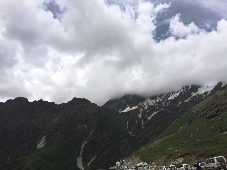
Spot the paraglider! Seriously, though, start early from Manali to avoid the tourist jam at Rohtang Pass

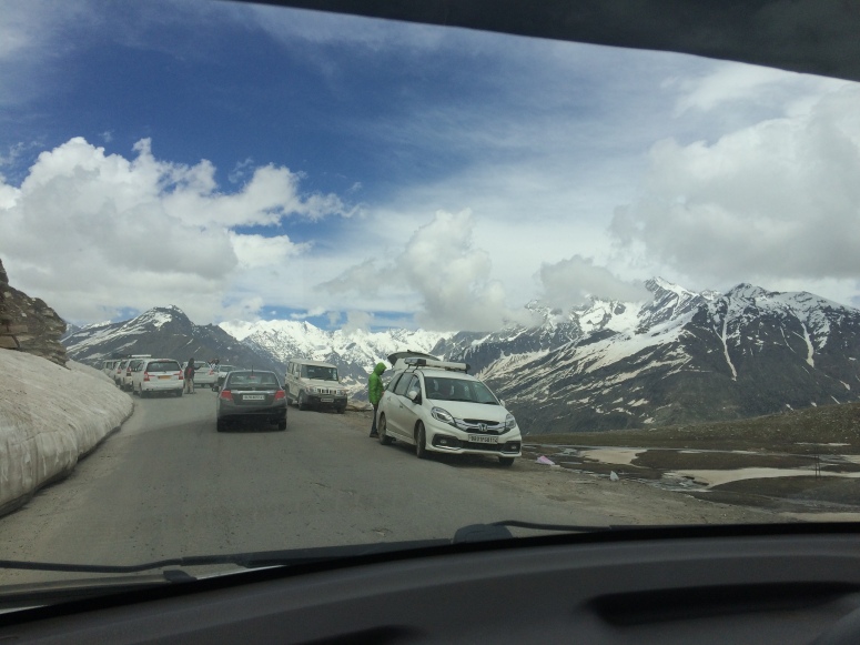
Early next morning, we started well and made it to the check point of Rohtang pass following the line of slow moving vehicles. There was only one booth that was operational (standard, by my previous experiences) so the passage made for slow going; still we made it through and got our permits checked and stamped. There were many tourists for a few kilometers, but soon we descended the rocky, damaged road and were on our way through the valley of Lahaul-Spiti.

IMG_3786
Snow makes the world a more beautiful place

This valley lies in Himachal Pradesh, and has two district headquarters – Keylong for Lahaul, and Losar for Spiti. For tripping to Spiti Valley’s Kaza and Chandertal, READ THIS POST about our journey and circumlocution of Chandertal last June (2016).

The way you can be sure of your timely progress is to keep driving till Koksar (where they check your permit), which is a small settlement along the valley’s major bridge. Keylong is a smooth ride from here on out, which is a huge relief after the traffic at Rohtang and the rocky road till Koksar.

We had stayed in Keylong last June, and we knew through research and folks’ tales that Sarchu, a popular name but unfortunate night-stay option, was quite far. Hence, we had settled it previously that we would stay at Jispa along the banks of the Bhaga river, and what a great decision it turned out to be.

IMG_3790
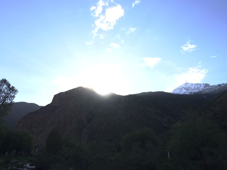
With the sun setting behind the Himalayas, we stuck to our decision of staying overnight at Jispa, NOT SARCHU

Earlier in Manali, we had casually enquired a local who had ‘Jispa Journey’ emblazoned on his jeep’s windscreen about the place. That got us the number of Mr S Gyaltsen, a Jispa native. Even though there is mobile coverage in Jispa, it is rare and erratic. As a happy consequence, while tracking the particular Jispa Journey place, we chanced upon a young lad, Gaurav Katoch, who had just set up two brand new tents. We were to be his very first guests at a very economical price, including dinner! We would be glad to refer you to him for advance bookings for adventure sports and accommodation, right on the river’s edge. Connect with us at @opendurbar on Twitter, @opendurbar_aa on Instagram, or opendurbar@gmail.com!

IMG_3789
Our stay location at Jispa – courtesy Gaurav Katoch

It was pretty windy, and Jispa is on the riverbank, making it colder still. The fun began as soon as we settled into the 5-man tent (4 of us, so plenty of room) and set up our seating spot plus table behind it, shielding us from the wind. I made a time lapse and it was everything I hoped it would be.

IMG_3810
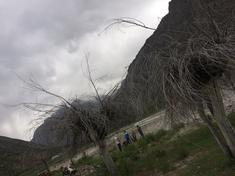
These interesting trees are concentrated at the end of the adjacent melting-snow stream

As evening drew on, Gaurav built a fire, and we hustled around it, reliving the drive up to Jispa and discussing the way ahead with our young host. He commended our decision to eschew Sarchu, as will become clear when we move on to Baralacha La and Tanglang La tomorrow. At Jispa, however, we had a simple, nutritious dinner and slumbered comfortably to the sound of roaring wind and rushing water.

Part 3: Baralacha La and Tanglang La – nearly snowed under!

Leh Ladakh June 2017: Part 1

ABOVE ALL ELSE: Make your trip zero-environmental-impact. Keep collecting ALL your non-biodegradable trash and deposit it into proper waste bins when you RETURN, not along the way or in nature. Every little bit we do has a positive effect – believe it.

Part 1: Delhi to Vashisht (Manali), before Rohtang Pass

At what I will consider, in hindsight, to be an auspicious odometer reading of 42, 706 km, we started from Delhi on a clear June evening. The moon was out early, and as its light spread across the night sky, we ascended the foothills of the mighty Himalayas by taking a bypass towards Ropar from Ambala. It was not a well-known route, but it saved the Kiratpur-Chandigarh bypass from being trod on by our new tires. 🙂

IMG_3745
I like 42 – it is the Answer to the Ultimate Question in Hitch Hikers’ Guide to the Galaxy

The early morning greeted us through the Kullu valley, the river tumbling down in the mischievous way mountainous rivers are wont to. Breathing in the air like Pink Floyd exhorts us to, we took a short breakfast break and steeled ourselves for facing the short but congested route through Manali city. I used to call it a town but it has gone the way most overcrowded tourist destinations go – to the dogs. Nevertheless, we had to get our permit for Keylong (NOT for Rohtang – those are for people returning the same day or next morning from the relatively near and equally crowded Rohtang pass).

IMG_3751
The endless river – more natural than Pink Floyd’s 🙂

PERMITS: IMPORTANT

The importance of this permit cannot be overstated. If you are in a locally hired vehicle, the driver may take care of this for you. All for a fee, of course. The in-person way to get this made for your own vehicle – we had a Honda Amaze (diesel) and a Hyundai Santro (petrol) – is to apply online at the website of the Sub Divisional Magistrate of Kullu-Manali [if you want to check it out right away: Permits for Rohtang]. The fee is only INR 50, but getting it done through touts or agents costs more – anywhere between INR 200 (if you’re not overly hoodwinked) to INR 500 (extravagant but quick). The pass is only available for the current and next day, so be sure of your traveling times before getting the permit either yourself or through someone.

If getting it done yourself, you will be required to enter your car’s details (Registration Certificate), driver’s details (Driving License), Pollution Under Control certificate etc. so keep these handy. As mentioned in driving advice available all over the Internet, your car should ideally be in top condition. On this note, I’d recommend reading (or at least taking along, for the literal ride) Zen and the Art of Motorcycle Maintenance by Robert Pirsig.

IMG_3762
The moon from Kullu valley

After getting the permit for Keylong – again, NOT just for Rohtang but for BEYOND Rohtang), we were ready for the last-stage preparations for our trip to Leh Ladakh.

IMG_3777
A valley-hugging cloud over Manali, seen from Vashisht

IMG_3775
A makeshift footbridge encountered during a late evening excursion

Part 2: Rohtang Pass, Koksar, Keylong, Jispa, before Baralacha La

ADVICE APPLICABLE THROUGHOUT: Ladakh is a beautiful but severe environment. The decision to visit should be taken in the most positive sense possible, anticipating unexpected events and preparing for them as much as one can. Stay in the moment, and learn to enjoy the vagaries of nature as they come. That being said, let’s head out of our homes and into the cold desert of the Himalayas! 🙂

Plan Outline: Ladakh, June 2017

We are considering leaving Delhi on 3rd/4th June to avoid the glut of weekend trippy hippies running away from Delhi. An overnight stay in old Manali/Vashisht is on the cards, depending on the group’s decision (by majority vote, of course). Next stop will be Keylong/Jispa (not Sarchu despite what people think). Next day, Leh! Pangong is a must, of course, and then we can cover Nubra Valley. You always have the option of leaving straight for Delhi after Pangong/Nubra, but we aim to soak in Kargil and Drass on the way to Srinagar. Again, Gulmarg and a few close-by tourist attractions are dependent on the situation in Kashmir at the time.

Paying our respects at the Golden Temple and Jallianwala Bagh in Amritsar is always a good way to be thankful for a (hopefully) successful trip.

We return to Delhi’s scorching heat after packing in as much adventure and fun as we can!

As you can see, it’s a flexible, no must-move-or-we-leave-you-behind trip. Let me know your thoughts! 🙏🏽😇

Update: completed rockingly successfully! 

Read up here: Delhi – Manali – Rohtang

Rohtang – Jispa – Leh

Leh – Pangong Tso – Leh

Chandertal

June 2016

We left from Delhi on 6th June, and attended my awesome friend’s wedding (shoutout to Ranaji’s family and Sunny in particular- we will get to him in a moment) in Kullu. Next up, we crossed Rohtang and stayed in great accommodations provided by our friend-to-be-married in Keylong.

The view till then had been spectacular, but we had a choice to make about our onward journey. At Abhi’s wedding, we were lightly cautioned against taking our reliable Honda Amaze to Spiti/Chandertal. Four of our college friends were already in a Traveller, so we parked our car at Koksar and were driven to Kaza.

The ride took the best part of the day, but we arrived in time to take in the sunset. Then began the wait for moonrise, which my trustworthy SkyView app predicted to be around 11:30 pm.

The photos themselves are two dimensional digital reproductions; the sensation of time was visibly suspended as the moon rose and rose, until the town of Kaza was bright with moonlight. I’m irresistibly reminded of the mural painted in white across the valley.

After a good night’s sleep, we loaded ourselves into the traveller and headed to Chandertal. Retracing part of the way we had taken, we re-crossed Losar, and turned towards Chandertal from Batal.

Before I forget, we had underestimated cash expenses in kaza, so we called Sunny and he generously booked places for us at very agreeable rates in his camp at Chandertal. This is the kind of bonhomie one gets to experience in Himachal.  Kudos and 🙏🏽😇.

Onward, then, to Chandertal. We made good progress mainly due to Sanjay, our guide and driver. His experience came in really handy on the loose roads leading to Chandertal. On the way, a couple were stranded with a faulty bullet. We took them along and ensured they had a tent when we crossed the campsite along the way.

Oh, man, the steep drive to the final parking lot is DUSTY! Stay slow to avoid getting caked in red soil like Nitin.

The stretch leading to Chandertal is about a kilometre or so. Along the way are the lower lakes and a view of the lake-river system down through the valley. It is best to reach as early as possible: you need time to emulate what 4 of us did ahead.

The green banks of grass pale in comparison to the dark green water of the moon lake. After splashing around a bit, Pradeep, Nimesh, Nitin and I embarked on the circumambulation.  It is an hour of utmost beauty, and the way is (or was, thankfully for us at the time) easy. Melting snow feeds the estuary-like beginning of the lake, and on the other side are the ubiquitous pyramids of flat stones piled atop each other. We added our own, with the setting behind snow capped peaks far down towards the west. It was only in January 2017 that I went higher: Bandipur in Nepal, near Pokhara and the Annapurna Dhaulagiri range. Come to think of it, that’s my twitter banner pic these days! But I digress.

We climbed down in the twilight, and were warmly received by our host – I forgot his name, but I’m sure we will remember it when our group gets together and conversations lead hither. A great dinner later, we stayed to watch the Milky Way and the Big Dipper revolve into view. Pranay took great long exposure shots of the bright moonlit valley and sky.

It is inadvisable to attempt an overnight camp at Chandertal itself, unless you’re an experienced outdoors person. Even then, take care whenever you find yourselves in the remote reaches of the Himalayas!

Next morning we returned, picked the couple’s bullet (more like rolled it downhill) and reached Manali in the evening. Of course, the Amaze reached slightly earlier due to traffic on Rohtang pass. We retired to old Manali and regrettably returned to Delhi’s heat the next day.